


Contact Info
- Phone 1:
- 605-574-4402
Basics
- Number of Sites:
- 12
Amenities
Basic Amenities
- Drinking Water
- Vault Toilets
Details
Season
Open through Tue Sep 03 2013Location
Getting There:GPS Info. (Latitude, Longitude):
44.42611, -104.42306
44°25'34"N, 104°25'23"W
To access the Reuter Campground from Sundance, travel west on US Highway 90 for approximately 1 mile. Turn off the interstate at Exit 185 and travel west on US Highway 14 for 1 mile. Turn right, or north, onto County Road 100 (FSR 838) and travel 3 miles to the campground.
Basic Info
- Total Sites:
- 12
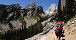
From this campground, visitors can access the Sundance Trail System from Reuter Trailhead. The secluded trails of this system weave through a network of densely forested canyons and open ridges that form the Bearlodge Mountains. Some ridge tops look out to the Custer Expedition Route, Devils Tower, and the Twin Missouri Buttes. Elk, deer and turkey are some of the more common wildlife seen along the trail.
Parts of the trail system have existed since the 1800s. As routes to reliable water and the only access to some parts of the Bearlodge Mountains, they played a key role in the rich mining history of the area.
The trail system is maintained for hiking, horseback riding, bicycling and cross-country skiing. Motorized vehicle traffic is not allowed; however, some portions of trails follow existing Forest Service roads open for motorized use.