


Weather information for the Leadville area is provided below. Average temperatures, climate details and current forecasts are included!
Climate
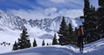
Leadville's high elevation means the climate tends toward the cold side. Summer days are warm and often in the 70s, and summer nights are chilly. During winter there are frequent snowstorms, and snow stays on the ground from October to May. Major roads in and around town are kept plowed during winter months. Travelers should spend a day acclimating to the altitude before attempting strenuous activity, and wear plenty of sunblock to protect against UV rays.
| Jan | Feb | Mar | Apr | May | Jun | Jul | Aug | Sep | Oct | Nov | Dec | ||
| Avg. High | 31 | 34 | 38 | 45 | 55 | 67 | 71 | 69 | 62 | 51 | 38 | 31 | |
| Avg. Low | 3 | 5 | 11 | 19 | 28 | 34 | 38 | 38 | 32 | 23 | 12 | 4 | |
| Precipitation | 0.6 | 0.8 | 0.9 | 1.1 | 0.6 | 0.8 | 1.8 | 1.8 | 0.9 | 0.7 | 0.8 | 0.7 | |
Live weather is currently unavailable.
Please visit weather.gov for current and forecasted weather.
Tonight
Slight Chance Snow Showers then Mostly Cloudy
Friday
Partly Sunny then Chance Snow Showers
Friday Night
Snow Showers Likely
Saturday
Snow Showers Likely
Saturday Night
Slight Chance Snow Showers then Partly Cloudy
Sunday
Sunny then Slight Chance Snow Showers
Detailed Forecast |
|
|---|---|
| Tonight | A slight chance of snow showers and a slight chance of thunderstorms before midnight. Mostly cloudy, with a low around 30. Southeast wind 10 to 15 mph. Little or no snow accumulation expected. |
| Friday | A chance of snow showers and a slight chance of thunderstorms between noon and 3pm, then a slight chance of thunderstorms and a chance of rain and snow showers. Partly sunny, with a high near 48. Northwest wind 5 to 15 mph. Chance of precipitation is 40%. New rainfall amounts less than a tenth of an inch possible. |
| Friday Night | Snow showers likely and a slight chance of thunderstorms. Mostly cloudy, with a low around 28. South wind 5 to 15 mph. Chance of precipitation is 60%. New snow accumulation of less than half an inch possible. |
| Saturday | A chance of snow showers before 9am, then snow showers likely and a chance of thunderstorms. Mostly cloudy, with a high near 45. West southwest wind 5 to 15 mph. Chance of precipitation is 70%. New snow accumulation of less than half an inch possible. |
| Saturday Night | A slight chance of snow showers and a slight chance of thunderstorms before midnight. Partly cloudy, with a low around 25. West northwest wind 5 to 15 mph. Chance of precipitation is 20%. |
| Sunday | A slight chance of snow showers after noon. Sunny, with a high near 50. West wind 5 to 15 mph. Chance of precipitation is 20%. |
| Sunday Night | A slight chance of snow showers. Partly cloudy, with a low around 31. West wind around 15 mph. Chance of precipitation is 20%. |
| Monday | Mostly sunny, with a high near 50. West wind 20 to 25 mph, with gusts as high as 40 mph. |
| Monday Night | Partly cloudy, with a low around 27. West wind 10 to 20 mph. |
| Tuesday | A slight chance of snow showers and a slight chance of thunderstorms between noon and 2pm, then a slight chance of showers and thunderstorms between 2pm and 5pm, then a slight chance of thunderstorms and a slight chance of rain and snow showers. Partly sunny, with a high near 51. West wind 10 to 20 mph. Chance of precipitation is 20%. |
| Tuesday Night | A slight chance of thunderstorms and a slight chance of rain and snow showers before midnight. Mostly cloudy, with a low around 29. Southwest wind 10 to 15 mph. |
| Wednesday | Mostly sunny, with a high near 53. Southwest wind 10 to 15 mph. |
| Wednesday Night | Partly cloudy, with a low around 28. West southwest wind 10 to 15 mph. |
| Thursday | A slight chance of snow showers after noon. Mostly sunny, with a high near 52. West southwest wind 10 to 15 mph. |