Wyoming Map

Request Free Visitor Guides

Mount Hedgehog Trail

Contact Info
White Mountain National Forest
33 Kancamagus Highway
Conway, NH 03818

Phone 1:
603-447-5448
Phone 2:
603-447-1989
Basics
Length:
5 miles
Difficulty:
Intermediate,
Difficult
Time:
1.5 - 2.5 hours

Description

The trail leaves from the parking area just east of Passaconaway Campground 13.5 miles west of Conway on the Kancamagus Highway.

Beginner hikers or those short on time should find this an appropriate hike. The trail takes you to the summit of Mt. Hedgehog (2520 ft.) The grade is moderate and only the final sections require a little extra effort. The advantage in taking the loop in a clockwise direction is to view the Presidential Range and Mt. Washington as you reach the summit from the south. The grade remains fairly constant for the first two miles, passing through birch and hemlock, and then soon dropping in and out of a ravine with a small brook nestled along the bottom.

Details

Length:
5 miles
Difficulty:
Intermediate
Difficult
Time:
1.5 - 2.5 hours
Additional Details:

Take a minute here to stop and listen for water, wind, and the cheeping of nuthatches and chickadees, the most common forest birds in the area. Continue climbing until the trail narrows and emerges out on the East Ledges. From here it is one mile to the exposed rock of the main summit to enjoy the views. Be careful near the ledges once you reach the top, especially if the conditions are wet or icy.Mt. Hedgehog is located just north of Mt. Passaconaway in the Swift River Valley. Hedgehog separates the valley of Oliverian Brook on its east, from that of Downes Brook on the west. Mt. Hedgehog, Mt. Potash and Mt. Whiteface surround Mt. Passaconaway, one of the area’s peaks above 4,000 feet.

Hedgehog is strikingly shaped with Allen’s Ledge on the north, and the huge East ledges on Little Hedgehog. The vantage point from Allen’s Ledge, located 1.1 miles up the west fork of the trail, affords a remarkable view of Mt. Passaconaway, Mt. Chocorua, the Moats, the Presidential Range, the Carrigain Range, and many other eastern peaks. On clear days even the observatory on top of Mt. Washington is visible.

SAFETY: Remember to bring water, food, warm clothes, headlamp, map, and wear good hiking footwear. Weather in the White Mountains can change quickly, always be prepared for rain or other inclement weather.

Map + Directions


Copyright © 1997 - 2024 The Go Travel Sites. All Rights Reserved and.

Email Page Link

Complete the form below to email this page to a friend or family member's email. You can send yourself an email as well. Your email and your recipient's email will NOT be shared with anyone. See our full Privacy Policy for details.
:
:
:


:
Copy Yourself on the Email Yes No
:
:

1

Select one or more Free Visitor Guides below

2

Complete the form to receive your guides by mail
Bear Lake Bear Lake Bear Lake
Northern UtahBear Lake Valley lies on the border of Utah and Idaho, and is home to the "Caribbean of the Rockies", or Bear Lake. Visitors can enjoy a myriad of outdoor activities throughout the entire year.
Request this Free Visitor GuideRequested! You're all set! Request a few more Visitor Guides, or complete the form below to receive your guides by mail.
Uintah County - Vernal Uintah County - Vernal Uintah County - Vernal
Northeastern UtahEnjoy Dinosaur National Monument, scenic byways, state parks, wilderness areas, heritage trails, petroglyphs, and family fun. It's world-class fishing, river running, biking, hiking, and camping in alpine meadows and red rock canyons.
Request this Free Visitor GuideRequested! You're all set! Request a few more Visitor Guides, or complete the form below to receive your guides by mail.
Logan - Cache Valley Logan - Cache Valley Logan - Cache Valley
Northern UtahCache Valley is known as one of Utah's most naturally beautiful areas. For a real treat, take a breathtaking drive along the Logan Canyon national Scenic Byway.
Request this Free Visitor GuideRequested! You're all set! Request a few more Visitor Guides, or complete the form below to receive your guides by mail.
Box Elder County Box Elder County Box Elder County
Northern UtahBox Elder County is known as a land of contrasts. Visit the the quaint and beautiful town of Brigham City, or get outside and experience any number of outdoor activities within scenic Box Elder County.
Request this Free Visitor GuideRequested! You're all set! Request a few more Visitor Guides, or complete the form below to receive your guides by mail.
Visit Idaho Visit Idaho Visit Idaho
IdahoStart planning your Idaho adventure. Vacation is more than just scenery; it’s about making life long memories. Download or order the free Idaho Travel Guide here.
Request this Free Visitor GuideRequested! You're all set! Request a few more Visitor Guides, or complete the form below to receive your guides by mail.
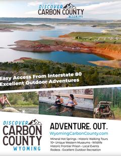
Carbon County Carbon County Carbon County
South CentralCarbon County, WY offers lots of great activities, fishing spots, area hiking, campsites, snowmobile trails, wildlife areas and cross country skiing trails and much more.
Request this Free Visitor GuideRequested! You're all set! Request a few more Visitor Guides, or complete the form below to receive your guides by mail.
Visit Moffat County Visit Moffat County Visit Moffat County
Northwestern ColoradoWelcome to Colorado’s Great Northwest, Moffat County has nearly 2 million acres of public lands to explore. Experience places like Dinosaur National Monument, the Sand Wash Basin Wild Horse Management Area and free flowing rivers including the mighty Yampa, last of the wild ones!
Request this Free Visitor GuideRequested! You're all set! Request a few more Visitor Guides, or complete the form below to receive your guides by mail.