Wyoming Map

Request Free Visitor Guides

Anteloper Reservoir

Contact Info
813 S.W. Hwy, 97
Madras, OR 97741
Basics
Size:
170 acres / .3 sq. miles
Max. Depth:
28 feet
Elevation:
4960 feet

Description

Antelope Flat Reservoir is located on the south side of the Maury Mountains, is encompassed by the Ochoco National Forest and is a great getaway from the more crowded campgrounds in the state. It is an irrigation impoundment that is situated near the headwaters of Bear Creek, a tributary of the Crooked River, and is formed by a 33-foot high earth fill dam at the west end of Antelope Flat. The landscape includes a nice mix of ponderosa pine, desert slopes, and weedy banks. Expect to find murky water conditions. Rainbow trout are found in the reservoir and average 12 inches although there have been reports of a high growth rate and good success by anglers with fish as large as 18 inches. Fingerlings are stocked in mid-May by ODFW. Early in the season, anglers line the bank near the concrete boat ramp and close to the rocks. The water is frequently turbid because of the growth of phytoplankton and because of bank erosion caused by surface waves, thus decreasing water transparency.

Fishing

Fish:
Rainbow Trout
Fishing Methods:
Trolling,Bank Fishing

Details

Size:
170 acres / .3 sq. miles
Max. Depth:
28 feet
Elevation:
4960
Water Access:
Cement boat ramp near dam.
Camping Info
Antelope Flat Reservoir Campground
Additional Details:

Bait/Lure Fishing Methods : Power bait, worms, eggs, caddis, midges, and other flies.

Amenities

Map + Directions

Basic Directions
Approximately 29 miles southwest of Prineville Highway 380, turn right on Forest Road 17 travel 11.5 miles turn left on Forest Road 1700-600 then 1/2 mile to reservoir.


Copyright © 1997 - 2024 The Go Travel Sites. All Rights Reserved and.

Email Page Link

Complete the form below to email this page to a friend or family member's email. You can send yourself an email as well. Your email and your recipient's email will NOT be shared with anyone. See our full Privacy Policy for details.
:
:
:


:
Copy Yourself on the Email Yes No
:
:

1

Select one or more Free Visitor Guides below

2

Complete the form to receive your guides by mail
Bear Lake Bear Lake Bear Lake
Northern UtahBear Lake Valley lies on the border of Utah and Idaho, and is home to the "Caribbean of the Rockies", or Bear Lake. Visitors can enjoy a myriad of outdoor activities throughout the entire year.
Request this Free Visitor GuideRequested! You're all set! Request a few more Visitor Guides, or complete the form below to receive your guides by mail.
Uintah County - Vernal Uintah County - Vernal Uintah County - Vernal
Northeastern UtahEnjoy Dinosaur National Monument, scenic byways, state parks, wilderness areas, heritage trails, petroglyphs, and family fun. It's world-class fishing, river running, biking, hiking, and camping in alpine meadows and red rock canyons.
Request this Free Visitor GuideRequested! You're all set! Request a few more Visitor Guides, or complete the form below to receive your guides by mail.
Logan - Cache Valley Logan - Cache Valley Logan - Cache Valley
Northern UtahCache Valley is known as one of Utah's most naturally beautiful areas. For a real treat, take a breathtaking drive along the Logan Canyon national Scenic Byway.
Request this Free Visitor GuideRequested! You're all set! Request a few more Visitor Guides, or complete the form below to receive your guides by mail.
Box Elder County Box Elder County Box Elder County
Northern UtahBox Elder County is known as a land of contrasts. Visit the the quaint and beautiful town of Brigham City, or get outside and experience any number of outdoor activities within scenic Box Elder County.
Request this Free Visitor GuideRequested! You're all set! Request a few more Visitor Guides, or complete the form below to receive your guides by mail.
Visit Idaho Visit Idaho Visit Idaho
IdahoStart planning your Idaho adventure. Vacation is more than just scenery; it’s about making life long memories. Download or order the free Idaho Travel Guide here.
Request this Free Visitor GuideRequested! You're all set! Request a few more Visitor Guides, or complete the form below to receive your guides by mail.
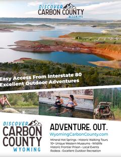
Carbon County Carbon County Carbon County
South CentralCarbon County, WY offers lots of great activities, fishing spots, area hiking, campsites, snowmobile trails, wildlife areas and cross country skiing trails and much more.
Request this Free Visitor GuideRequested! You're all set! Request a few more Visitor Guides, or complete the form below to receive your guides by mail.
Visit Moffat County Visit Moffat County Visit Moffat County
Northwestern ColoradoWelcome to Colorado’s Great Northwest, Moffat County has nearly 2 million acres of public lands to explore. Experience places like Dinosaur National Monument, the Sand Wash Basin Wild Horse Management Area and free flowing rivers including the mighty Yampa, last of the wild ones!
Request this Free Visitor GuideRequested! You're all set! Request a few more Visitor Guides, or complete the form below to receive your guides by mail.