


Below you will find helpful information about Wind River Range.
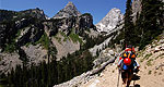
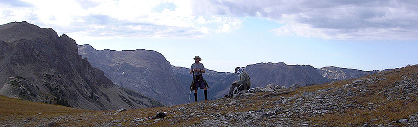
Overview
Three federal wilderness areas and a proposed wilderness study area protect over 785,000 acres of land and over 700 miles of trail within the Wind River Range. The Wind River Mountain Range and associated wilderness areas are circumnavigated by road systems, allowing for a variety of trail access points. The Union Pass road lines the western edge of the Wind River Range and connects Dubois and Pinedale, US Highway 26 runs along the northeast section of the range through Dubois, US highway 191 runs along its southwestern edge through Pinedale and state highway 28 runs along its south eastern border through Lander. Visitors can find dining and accommodation options at any of the major towns surrounding the Wind River Range.
Bridger Wilderness
The Bridger Wilderness section of the Wind River Range incorporates the entire western flank of the mountains as they fall away from the continental divide. At just over 428,000 acres, the Bridger Wilderness is the largest of the three wilderness areas that protect the Wind River Range and features over 600 miles of trails, 27 glaciers, and a variety of peaks over 13000 feet. The most popular trail access points to this part of the Wind River Range originate close to Pinedale and include the Green River Lakes Access, the Big Sandy Access and the Elkhart Park Access.
Big Sandy is best reached by driving east from Pinedale to Boulder and then navigating the long gravel road system to its north. This access marks the southwestern terminus for the 72 mile long Highline Trail, and is also the best access for climbers and hikers alike looking to gain access to the magnificent Cirque of Towers are of the Wind River Range.
Elkhart Park is best accessed from Pinedale via the Skyline Road. Elkhart Park trailhead offers access to a good number of trails, including a variety of short hikes that will appeal to the casual day hiker. Visitors wanting just a taste of the scenic majesty that the Wind Rivers have to offer without committing to a multiple day hiking epic will enjoy the Photographers Point Trail. Elkhart Park is also a favorite access for backpackers and climbers wishing to access the Titcomb Basin Area, the access point to the four 13000 foot peaks (Mt. Helen, Freemont Peak, Jackson Peak and Mt. Sacagewea) that are dominate the skyline above the town of Pinedale.
Another access popular with backpackers is the Green River Lakes Access located to the Northwest of Pinedale. This trailhead allows for access to both Squaretop Mountain, an impressive cube shaped massif, and the popular Highline Trail which when traveled in full allows backpackers to traverse 72 miles into the heart of the Wind River Range. Visitors should check with the local Forest Service Ranger Station or at one of the handful of knowledgeable outdoor outfitter shops in Pinedale for more information on specific hikes, climbs and guide and outfitter operations that provide services in the Bridger Wilderness.
Popo Agie Wilderness
At more than 101,000 acres, the Popo Agie (pronounced po-po-zha) Wilderness area protects the southeastern section of the Wind River Range and is best accessed via several trail access points outside Lander. Just north of Lander, the Dickinson Park trailhead provides access to numerous trails within the Popo Agie (pronounced po-po-zha) wilderness section of the Wind River Range. The North Fork trail which starts at Dickinson Park is a popular route amongst hikers looking to access the Cirque of Towers, an amazing display of peaks including Warbonnet, Warrior, Pingora, Lizard Head and Sharks Nose, all which rise above 13,000 feet. The Cirque of Towers is extremely popular with big wall climbers from around the world looking for a challenge. Alternate access from the Middle Fork Trail to the Cirque of Towers and the popular Tayo Lake area of the Popo Agie Wilderness is available to the south of Lander via the Loop Canyon Road and Sinks State Park.
Fitzpatrick Wilderness
Protecting close to 200,000 acres, the Fitzpatrick Wilderness covers the northeastern section of the Wind River Range and is bordered by the Wind River Indian Reservation to the East and the Dubois area to the north. The Fitzpatrick Wilderness has 44 glaciers in its mountains, including the largest in the range at over 1200 acres. This wilderness also has the highest peaks in the Wind River Range, including Wyoming's highest, Gannett Peak. The most popular trailhead in the Fitzpatrick Wilderness is Trail Lake, which provides access to a number of trails, including the popular Glacier Trail. Glacier Trail provides access to Dinwoody Glacier, one of the largest glaciers in the Wind River Range and a popular access up to the top of Gannett Peak for mountaineers looking to summit.


