Wyoming Map

Request Free Visitor Guides

Alligator River Route

Basics
Location:
Alligator River Route is located on the eastern portion of North Carolina
Length:
71 miles (114 km)
Time:
1.5 hours
Fees:
No fees to drive the byway.

Description

Alligator River Route travels through the wetlands of North Carolina from Lake Mattamuskeet to Roanoke Island. It passes through swamp lands and wildlife refugees, where migratory birds gather and endangered species are protected.

The road follows Route 94 north from New Holland, then east on Route 64. After crossing Croatan Sound, the byway continues on Route 64/264 to its terminus at Roanoke Island.

Along the way, historic towns and old Native American villages greet the traveler. Places like Croatan Sound and Manteo give the visitor an excellent opportunity to get acquainted with the American Indian history and lifestyle. And, it provides a bird's eye view of what life may have been like during the early years of this nation.

Attractions

Fort Raleigh National Historic Site protects and preserves knownportions of England’‘s first New World settlements from 1584 to 1590....

Points of Interest

Points of Interest Along The Way

Alligator River National Wildlife Refuge (NC)

Opportunities for recreation in a natural setting abound at the Alligator River National Wildlife Refuge. This unique area is full of rare and not-so-rare wildlife and birds. Visitors will be able to explore the swampy area and all of its intriguing characteristics. Trails throughout the refuge invite visitors to explore or to try hunting or fishing. Although trails are available, the refuge is still very much a wilderness that can be difficult to navigate.

Directions

Along the Alligator River

Bodie Island Lighthouse (NC)

This lighthouse was built in 1872 to replace the one that was destroyed in the Civil War.

Directions

Located near the byway on the Outer Banks

Chicomacomico Lifesaving Station (NC)

This lifesaving station is famous for a rescue that occurred in World War I.

Directions

Located near the byway off of NC 12.

Fort Raleigh National Historic Site (NC)

The disappearance and fate of all settlers of Roanoke Colony remains a mystery to this day.

Directions

Fort Raleigh NHS is on Roanoke Island, and is located off US 64-264, three miles north of Manteo, NC. The site is 2 miles southeast of Norfolk, VA and 197 miles east of Raleigh, NC.

Lake Mattamuskeet (NC)

The name for Lake Mattamuskeet comes from an Indian word for"shallow lake" or "moving swamp." Only 5 feet deep, the lake isfreshwater. Residents once attempted to drain the lake for farmingpurposes, but the lake is now preserved as a wildlife refuge.Visitors can enjoy a visit to this now serene lake.

Directions

This shallow lake is located at the end of the byway on NC 94.

Manteo (NC)

Although Manteo was founded at the turn of the century, it has roots in one of the most historic places in the country.

Pocosin Lakes National Wildlife Refuge (NC)

Established in 1990, this refuge protects a unique type of swamp called pocosin, an Indian word meaning swamp on a hill.

Roanoke Island Festival Park (NC)

History of the 16th century is celebrated here. Learn about Roanoke Island's mysterious past.

Directions

Just off the byway on Roanoke Island

Details

Location:
Alligator River Route is located on the eastern portion of North Carolina
Length:
71 miles (114 km)
Time:
1.5 hours
Main Roads:
N Carolina 94 N and US-64 E
Fees:
No fees to drive the byway.

Map + Directions

Customizable Directions


Copyright © 1997 - 2024 The Go Travel Sites. All Rights Reserved and.

Email Page Link

Complete the form below to email this page to a friend or family member's email. You can send yourself an email as well. Your email and your recipient's email will NOT be shared with anyone. See our full Privacy Policy for details.
:
:
:


:
Copy Yourself on the Email Yes No
:
:

1

Select one or more Free Visitor Guides below

2

Complete the form to receive your guides by mail
Bear Lake Bear Lake Bear Lake
Northern UtahBear Lake Valley lies on the border of Utah and Idaho, and is home to the "Caribbean of the Rockies", or Bear Lake. Visitors can enjoy a myriad of outdoor activities throughout the entire year.
Request this Free Visitor GuideRequested! You're all set! Request a few more Visitor Guides, or complete the form below to receive your guides by mail.
Uintah County - Vernal Uintah County - Vernal Uintah County - Vernal
Northeastern UtahEnjoy Dinosaur National Monument, scenic byways, state parks, wilderness areas, heritage trails, petroglyphs, and family fun. It's world-class fishing, river running, biking, hiking, and camping in alpine meadows and red rock canyons.
Request this Free Visitor GuideRequested! You're all set! Request a few more Visitor Guides, or complete the form below to receive your guides by mail.
Logan - Cache Valley Logan - Cache Valley Logan - Cache Valley
Northern UtahCache Valley is known as one of Utah's most naturally beautiful areas. For a real treat, take a breathtaking drive along the Logan Canyon national Scenic Byway.
Request this Free Visitor GuideRequested! You're all set! Request a few more Visitor Guides, or complete the form below to receive your guides by mail.
Box Elder County Box Elder County Box Elder County
Northern UtahBox Elder County is known as a land of contrasts. Visit the the quaint and beautiful town of Brigham City, or get outside and experience any number of outdoor activities within scenic Box Elder County.
Request this Free Visitor GuideRequested! You're all set! Request a few more Visitor Guides, or complete the form below to receive your guides by mail.
Visit Idaho Visit Idaho Visit Idaho
IdahoStart planning your Idaho adventure. Vacation is more than just scenery; it’s about making life long memories. Download or order the free Idaho Travel Guide here.
Request this Free Visitor GuideRequested! You're all set! Request a few more Visitor Guides, or complete the form below to receive your guides by mail.
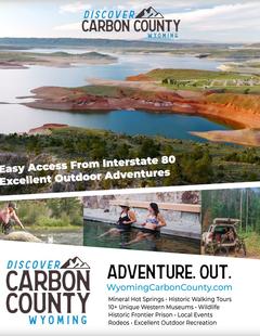
Carbon County Carbon County Carbon County
South CentralCarbon County, WY offers lots of great activities, fishing spots, area hiking, campsites, snowmobile trails, wildlife areas and cross country skiing trails and much more.
Request this Free Visitor GuideRequested! You're all set! Request a few more Visitor Guides, or complete the form below to receive your guides by mail.
Visit Moffat County Visit Moffat County Visit Moffat County
Northwestern ColoradoWelcome to Colorado’s Great Northwest, Moffat County has nearly 2 million acres of public lands to explore. Experience places like Dinosaur National Monument, the Sand Wash Basin Wild Horse Management Area and free flowing rivers including the mighty Yampa, last of the wild ones!
Request this Free Visitor GuideRequested! You're all set! Request a few more Visitor Guides, or complete the form below to receive your guides by mail.